Portion of a porcelain enamel Washington, D.C. license plate; link to site home page.

Eastern Ave., NW, Tacoma Park, Md., in October 2007


This is believed to be the location of the 1912 image in Gallery 10-2 in which a touring car is shown stopped at a toll house at the D.C.-Maryland border. The scene above is a section of Tacoma Park, Md., on Eastern Ave., NW, just north of Piney Branch Road. The double-yellow line in the center of the street is the border between Maryland (on the right) and Washington, D.C., as far as where the pavement type and color changes, beyond which is entirely Maryland. Note the METRO train behind the line of trees, operating on the same railroad right-of-way that can be seen behind the trees in the 1912 image.

Scouting done and photograph taken by J. Reid Williamson in October 2007.


navigation bar element linking to modern image of scene above

navigation bar element linking to Capitol Traffic home pagenavigation bar element linking to top of this pagenavigation bar element linking to DCplates.com home page

1911 North Market St., Frederick Md., in February 2008


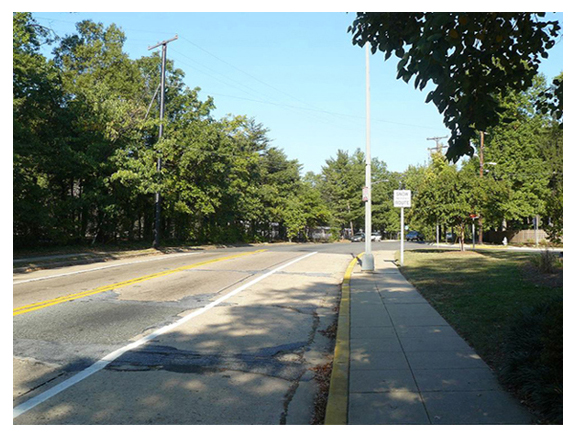
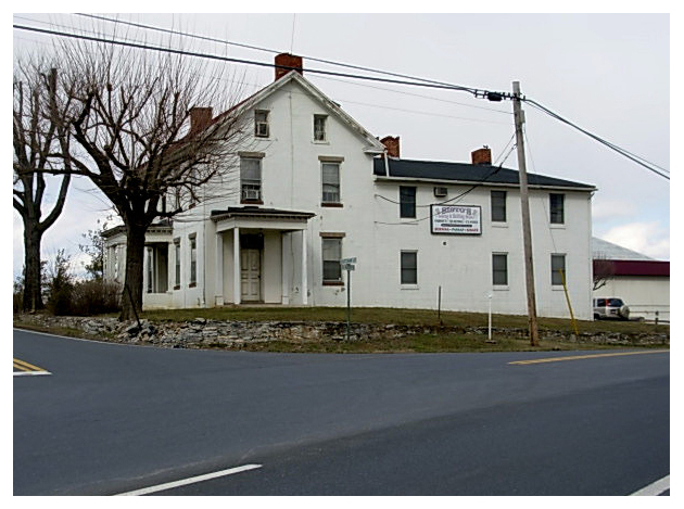
This 1800s farmhouse at 1911 North Market St. in Frederick, Md., which today is Sisto's Sewing and Quilting Sudio, is the same building shown on May 1, 1910, at the top of Gallery 10-3. Ninety-eight years ago, N. Market St. (foreground) was the main road to and from Frederick to the northeast. Before construction of what today is U.S. highway 15, which leads to Gettysburg, Pa., northbound travellers left Frederick by turning left onto what today is Routzahns Way.

The door to the home that faces N. Market St. is a side entrance, with the main entry on the front (on the left side of photos old and new). The most noticeable change made to the structure during the last century is the extension of the previously recessed right rear wall to meet the wall with the side entrance.

Scouting done and photograph taken by Charlie Gauthier and J. Ray Frank in February 2008.


navigation bar element linking to modern image of scene above

navigation bar element linking to Capitol Traffic home pagenavigation bar element linking to top of this pagenavigation bar element linking to DCplates.com home page

Looking southbound down 17th St. SW at Constitution Ave. NW, March 2008


What a difference 98.5 years makes. The 17th St. SW right-of-way has been shifted slightly to the east, and the road narrowed, in the past century. This view, taken in early March 2008, shows the same perspective as our Sept. 1909 image, although what was B Street back then is now Constitution Avenue. The Chesapeake and Ohio Canal lock keeper's house has been restored, possibly first in 1928 when the descriptive plaque (below) was added.

Scouting done and photographs taken by Charlie Gauthier in March 2008.


Chesapeake and Ohio Canal lock keeper's house, c.1835

  Plaque identifying the Chesapeake and Ohio Canal lock keeper's house

navigation bar element linking to modern image of scene above

navigation bar element linking to Capitol Traffic home pagenavigation bar element linking to top of this pagenavigation bar element linking to DCplates.com home page


D.C. flag

This page last updated on December 31, 2017

DCplates.net logo
copyright 2006-2018 Eastern Seaboard Press
Information and images on this Web site may not be copied or reproduced
in any manner without consent of the owner.
For information, send an e-mail to admin@DCplates.net